
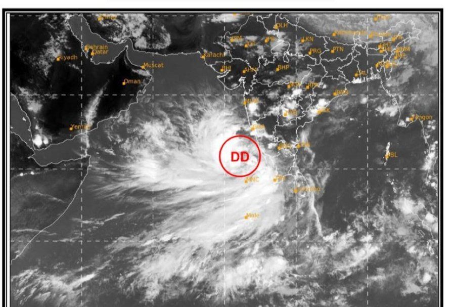
The depression formed over Lakshadweep in the Arabian Sea would turn into a cyclonic storm in the next 24 hours and reach near the Gujarat coast on the morning of May 18, the Indian Meteorological Department (IMD) said on Friday. Officials warned that Cyclone Tauktae might transform into a “very severe cyclonic storm” with a wind speed of up to 160 km/hr.
This cyclonic activity would bring rain or thunderstorm in the coastal belt between May 16 and 18, with some of the places in the region receiving heavy to extremely heavy rainfall on Monday and Tuesday.
The cyclone, which is predicted to form over the southeast Arabian Sea, is heading for Gujarat and the adjacent coast of Pakistan, and is expected to make landfall by May 18.
Also Read | Will Mars give China’s rover a warm welcome or a fiery goodbye?
In light of Cyclone Tauktae’s rapid intensification, the India Meteorological Department (IMD) has issued a heavy rain alert (more than 204mm) for some regions of Maharashtra, Kerala, and Gujarat.
In five districts of Kerala, the code red alert, which indicates extremely heavy rains, has been implemented. The IMD has issued a red alert for extremely heavy rains in Alappuzha, Thiruvananthapuram, Pathanamthitta, Kollam, and Ernakulam on Friday.
The current well-marked low-pressure system over Lakshadweep formed into a depression on Friday. On Friday, the IMD announced a cyclone watch and revealed the cyclone’s probable path.
Also Read | Bharat Biotech sends Covaxin to many states, says allegations ‘disheartening’
Warm sea-surface temperature over the Arabian Sea, according to IMD officials, has aided the system’s rapid intensification. Wind speeds of 50 to 60 km/hr, with gusts up to 70 km/hr, are predicted along the west coast until May 18.
The Indian Navy has put its aircraft, helicopters, diving and disaster relief teams on a standby for “rendering full support to state administrations as the cyclonic storm approaches western coasts,” its spokesperson said in a statement.
The National Disaster Response Force’s (NDRF) spokesperson Satya Pradhan too gave the details of the teams deployed in the five states.
Cyclones are common in the North Indian Ocean area, which includes the Arabian Sea and the Bay of Bengal, in May or November. Three out of four cyclones that develop in the area in a year originate in the Bay of Bengal.
Also Read | Michel Lotito — The man who ate aeroplanes for breakfast
According to the Regional Specialized Meteorological Centre for Tropical Cyclones over the North Indian Ocean’s cyclone records, only 33 cyclones formed over the Arabian Sea in May from 1891 to 2021.
However, due to increasing sea-surface temperature, the Arabian Sea has seen a rise in cyclogenesis in past years.
Severe Cyclonic Storm Nisarga formed here in June of last year and hit land near Alibag in Maharashtra’s Raigad district, wreaking havoc on the coastal city.


