
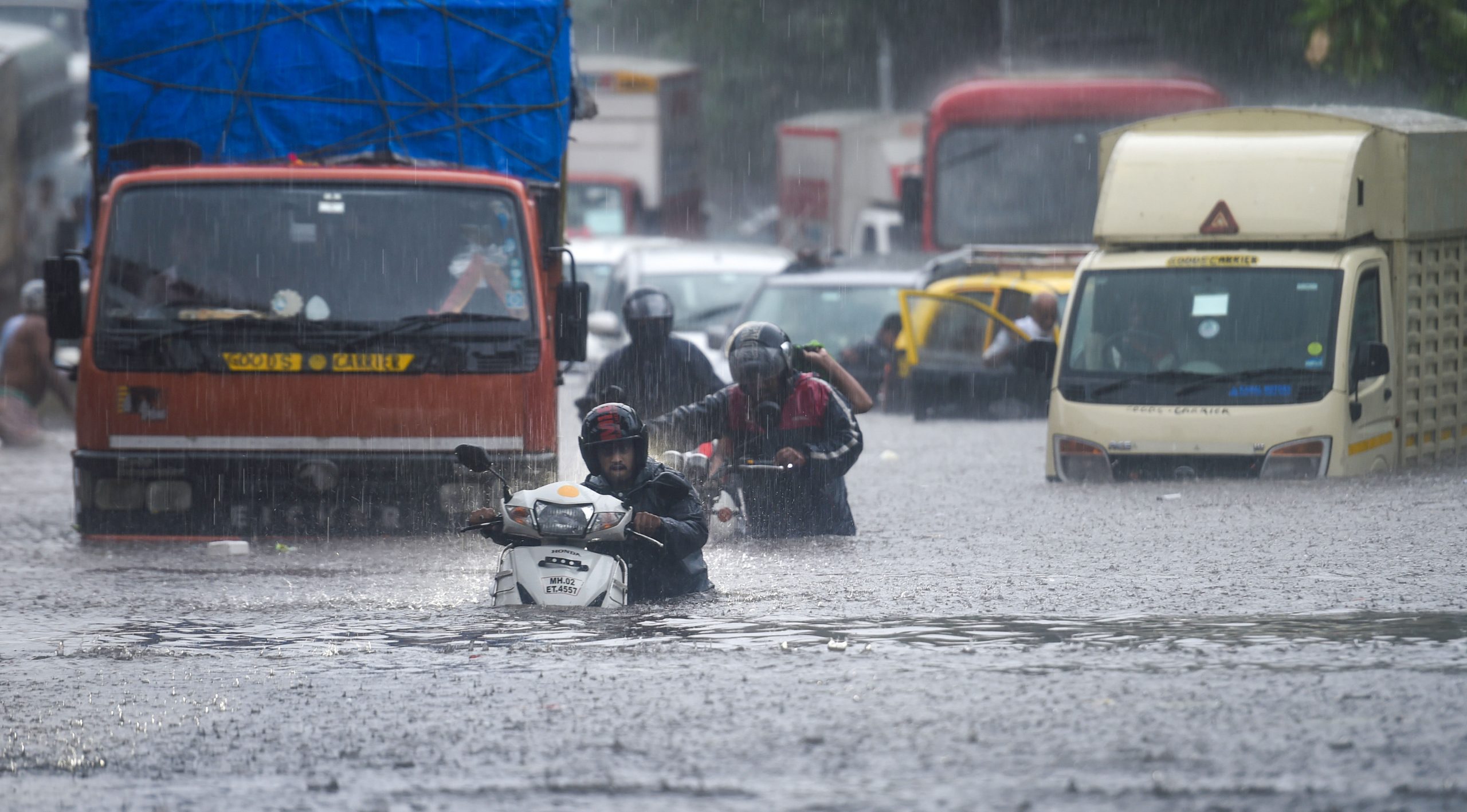
Floods, waterlogging, delayed and mostly cancelled trains, diverted bus routes, traffic, accidents and all that fuss is what Mumbai rains are about every year. Scenes on Wednesday narrated a similar story when heavy rainfall lashed the financial capital.
The weather department issued a red alert for Mumbai, neighbouring Thane, Palghar and Raigad districts, warning of very heavy to extremely heavy rainfall at isolated places.
Also read: Amid dip in cases, India records highest one-day COVID deaths. Here’s why
Pictures of waterlogged roads and tracks floated on the internet and it was only the first heavy rain in the city.
Why does Mumbai flood every monsoon?
1) Outdated drainage system and poor maintenance
Mumbai’s nearly 150-year-old drainage system is a network of surface drains across 2,000 km and underground drains of about 440 km. Build by the Britishers for a ‘mostly green’ island city, the drainage has failed to contain water when it rains heavily.
Also read: Film on Sushant Singh Rajput on track, Delhi HC turns down-stay plea
“The drainage system was designed considering that 50% of rainwater will be going through drains and the rest will percolate into the groundwater. Now very few parts in south Mumbai are open but the underground drainage system has remained the same,” environmentalist Debi Goenka told The Indian Express in 2020.
“They [drains] are heavily silted and punctured at many places. Their outfall to the sea is affected by high tides as 42 of 45 outfall lack flood gates,” the Comptroller and Auditor General of India, in its report tabled in the state Assembly in 2019 stated.
Also read: Here is how you can rectify COVID vaccine certificate errors on CoWIN
2) Depleting natural space
Simple science – rainwater permeates through soil. With the amount of construction, Mumbai has seen in the past decades, natural space has depleted rapidly. Now the rainwater, rather than being absorbed by land, stays stagnated on concrete. Waste generated by the construction sites clog up the drains and the water doesn’t have an escape.
3) Low-lying areas
Mumbai’s DG Ruparel College, Dadar is flooded every monsoon, so much that students, knee covered in water, face difficulty to go to the canteen. Dadar, Mahim and Matunga is a low-lying stretch that floods with the first rains. In a 2019 Mongabay report, Kanchan Srivastava and Aditi Tandon stated that the trend of reclamation of land that the city has been historically a witness to has also played a part in choking it up when heavy rainfall strikes.
Also read: COVID treatment guidelines for kids: No Remdesivir, cautious use of CT scan and steroids
Srivastava and Tandon came to the conclusion that the city swelled by almost 50 sq km in less than three decades since 1991. Most reclaimed land is essentially low-lying and, hence, flood-prone.
4) Overflowing rivers
Rivers in Mumbai, especially the Mithi, have become a veritable sewer, choked with domestic and industrial waste and overflows every monsoon, the Mongabay report states. The shrinking wetlands along these rivers mean that there is no buffer between the waterline and adjoining localities.


