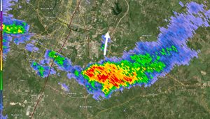
The end of February is slated to bring a derecho to the central and eastern United States. While most people in the US have heard about tornados and hurricanes, rarely have people heard of the weather-related term, derecho.
A derecho is all set to pelt across the US mainland, starting from Sunday, February 26.
What is Derecho?
A derecho, which is pronounced “deh-REY-cho,” is a widespread storm. It is a term that finds its meaning in Spanish which means creates a wall of wind stretching for hundreds of miles. It means “right,” “direct,” or “straight ahead” in Spanish. It brings as much destruction as a tornado or a hurricane.
Also Read |Where did the tornado hit in New Jersey? National Weather Service issues advisory
This is not the first time that a derecho is scheduled to wash over the US. They typically occur in the spring and summer and take place in waves across the central and eastern regions of the United States.
It is defined as “a widespread, long-lived windstorm that is associated with a band of rapidly moving showers or thunderstorms” by the National Oceanic And Atmospheric Administration (NOAA). There are certain conditions that needs to be fulfilled for a storm to be considered a derecho. For starters, it must travel at least 240 miles and reach speeds of at least 58 miles per hour.
Also Read | Mount Washington, New Hampshire summit weather record: Video shows wind chill at -110°, speed at +140mph
Derecho has also been referred to as bow echoes, squall lines, or quasi-linear convective systems. It was first used to describe some specific kinds of storms in 1888. It was coined by Dr. Gustavus Hinrichs, a physics professor at the University of Iowa.
Last summer saw 4 back-to-back derechos back-to-back, in the months of May, June, and July. The most recent derecho took place on July 5, 2022, in the upper midwest, causing wind damage for miles. It also produced two tornadoes that hit Iowa. Before that, the Great Lakes were hit in June.
In 2021, there was just one recorded derecho, in December.

