
Remnants of Hurricane Ida caused rainfall in Gulf Coast states into
New England on Tuesday. Tropical Storm Kate has swirled far away from Atlantic
shores. However, one cause of alarm is that another tropical depression is brewing
off the coast of Africa.
Hurricane Ida weakened to a tropical depression with maximum
wind speeds of 48kmph. It was centred mostly over northern Mississippi. The United
States’ National Weather Service said that flash floods might take place in
central Pennsylvania, northern West Virginia and western Maryland, where 15 to
25 centimetres of rain is expected.
Weather forecasters said that Ida was most likely to spawn
tornadoes in eastern Alabama, western Georgia and Florida Panhandle. Meanwhile,
tropical storm Kate seems loosely organised and should remain far from any
shore in the central Atlantic, according to the US National Hurricane Center
based out of Miami.
Meanwhile, in what could emerge as a cause for concern over the
next few days, forecasters say another tropical cyclone is forming off the
coast off Africa, blowing across the Atlantic a couple of hundred miles
west-southwest of the coast of Guinea.
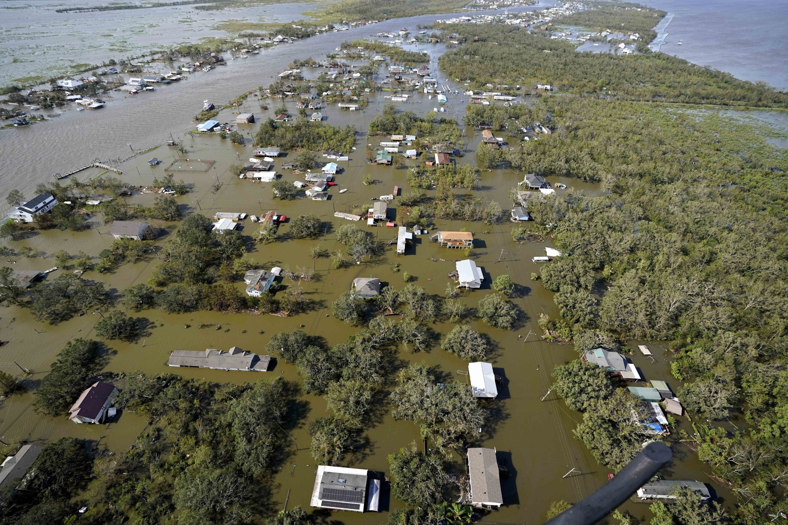
Hurricane Ida caused immense damage to the Gulf Coast over the
last couple of days. Residents not only survived devastating winds and a deluge
of rain, but also had to face widespread power outages. Some of the outages may
take some time to get fixed.
Hurricane Ida made landfall on Sunday as a Category 4 hurricane.
At least four lives have been lost in the hurricane and hundreds of people have
had to be rescued. Rescuers have found it difficult to access some of the
hardest-hit areas.
The National Weather Service issued a heat advisory for southern
Louisiana and Mississippi from 10 am to 5 pm Tuesday. That means, people
battling power outages, will see heat rise up to 105 degrees without air
conditioning.


