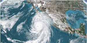
Evacuation efforts in the coastal zones of the Philippines have begun as Typhoon Noru heads towards Luzon, the country’s main island.
The incoming storm has undergone what forecasters say is “explosive intensification,” a weather phenomenon where a tropical cyclone rapidly grows stronger in a short period of time. The intensification occurs when the waters are extremely warm and the cooler waters further down in the ocean don’t churn upwards.
Noru has been classified as a Category 3 Typhoon and is currently travelling at speeds of 195km/h. The resulting weather could trigger landslides, flash floods and storm surges in the areas that it is moving towards, including in the capital city, Manila.
The Philippines is an archipelago of more than 7,000 islands in the Pacific Ocean, making it highly susceptible to storms of such intensity. Last year, when Typhoon Rai hit the country in December, it left over 400 people dead and $1 billion in damages.
Also Read | In pics | Devastation caused by powerful typhoon that battered the Philippines
What is Typhoon Noru?
Typhoon Noru is a tropical cyclone in the western Pacific Ocean currently threatening the Luzon, the main island of the Philippines. It is known as Super Typhoon Karding in the archipelago nation.
Also Read | Tropical storm Fiona: All you need to know
It’s formation was first detected by the Japan Meteorological Agency on September 21 after which the Joint Typhoon Warning Center in Hawaii issued a notice saying that the low-pressure system could develop into a tropical cyclone. A few hours later, the JTWC upgraded the notice saying it had become a tropical depression.
Hours after the JTWC issued its notice, the Philippine Atmospheric, Geophysical and Astronomical Services Administration followed suit and gave it the designation Karding. Shortly after that, it reached tropical storm strength and the JMA designated it as Noru.
Also Read | Storms kill 20 in Assam, over 200 houses damaged in Mizoram
On September 23, the PAGASA upgraded its warning to Tropical Cyclone Wind Signals 1, the day after, it was raised to TCWS #3 a day later on September 24. PAGASA has raised TCWS #5 at the moment as wind speeds have gone up to 195km/h.

