
Hurrican Ian upgraded to a Category 3 storm shortly before making landfall in Cuba early on Tuesday morning. It is expected to bring a storm surge and hit wind speeds of up to 140 mile per hour sometime this week, according to the US National Hurricane Center.
It hit western Cuba at maximum wind speeds of 125 mph, according to forecasters. As a result of the storm, the NHC has said that the island country’s western coast could rise as much as 14 feet thanks to a storm surge. However, when Ian hits Florida sometime this week, the surge is expected to be less severe although some parts of the Sunshine State can expect water levels to rise by five to 10 feet above normal.
Over the next 48 hours, the storm is expected to move upwards towards the north and the northeast but it remains to be seen when exactly the storm will make landfall on the US mainland.
Florida Governor Ron DeSantis declared an emergency in 24 counties of the state ahead of Ian’s arrival on September 25. This is the fourth Atlantic hurricane of the 2022 season. Usually, the season starts in June and goes all through till November. However, the first hurricane was only reported earlier this month.
The 2022 season was expected to see an above-average number of hurricanes, a prediction which did not come to pass with weather experts saying that fluctuating jet streams and heat waves in northern latitudes are to blame.
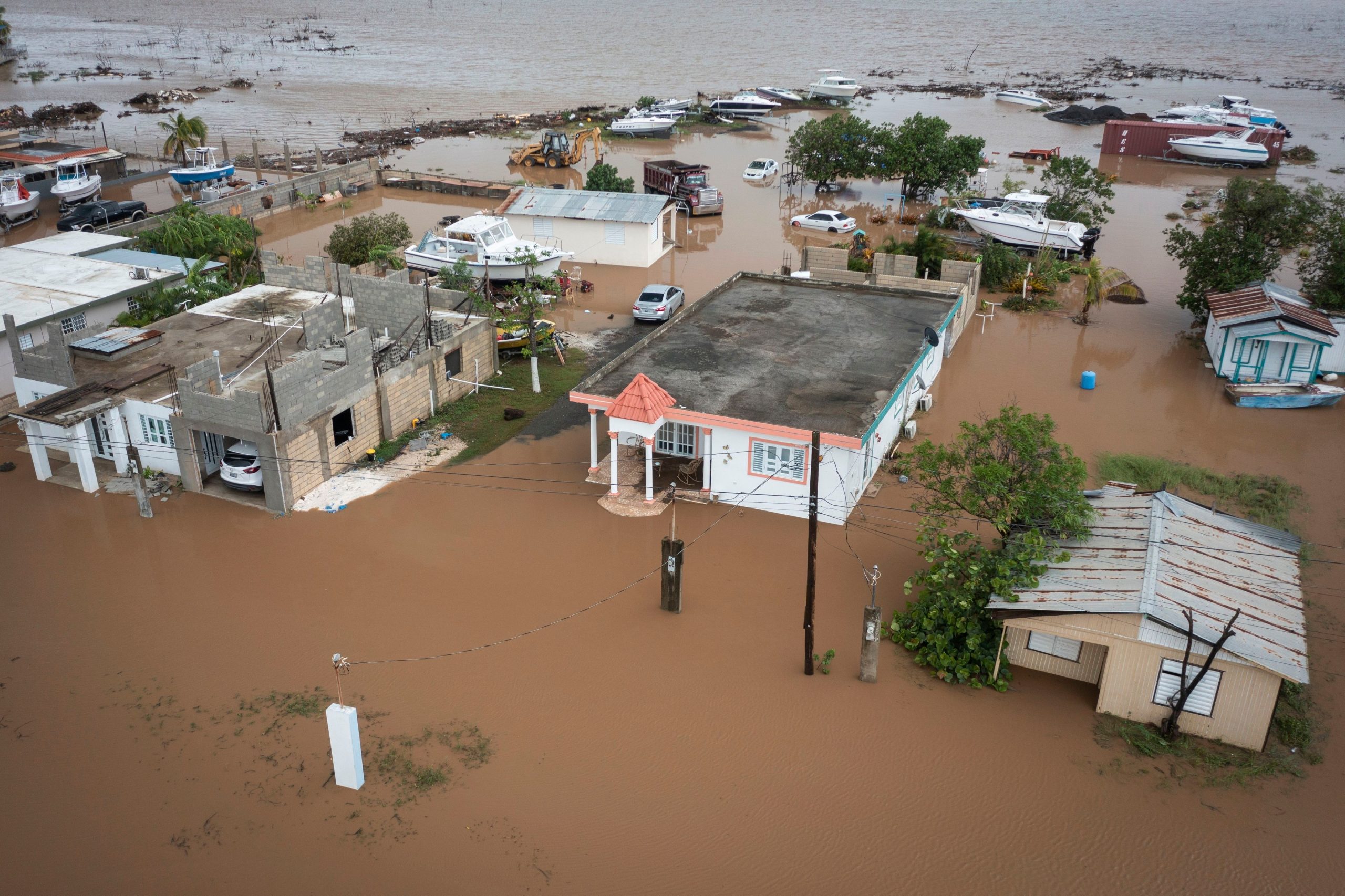
Also Read | Hurricane Fiona strikes Dominican Republic after Puerto Rico, leaves 3 dead
The storm was first identified last week on Friday and called Tropical Depression Nine before being reclassified as Hurricane Ian shortly after. With its classification as a Category 3 storm, Ian is expected to strengthen and cause potentially life-threatening storm surges and winds.
Ian comes just days after Hurricane Fiona hit Puerto Rico and the Dominican Republic leaving both places with flooding and dangerous land slides.


