
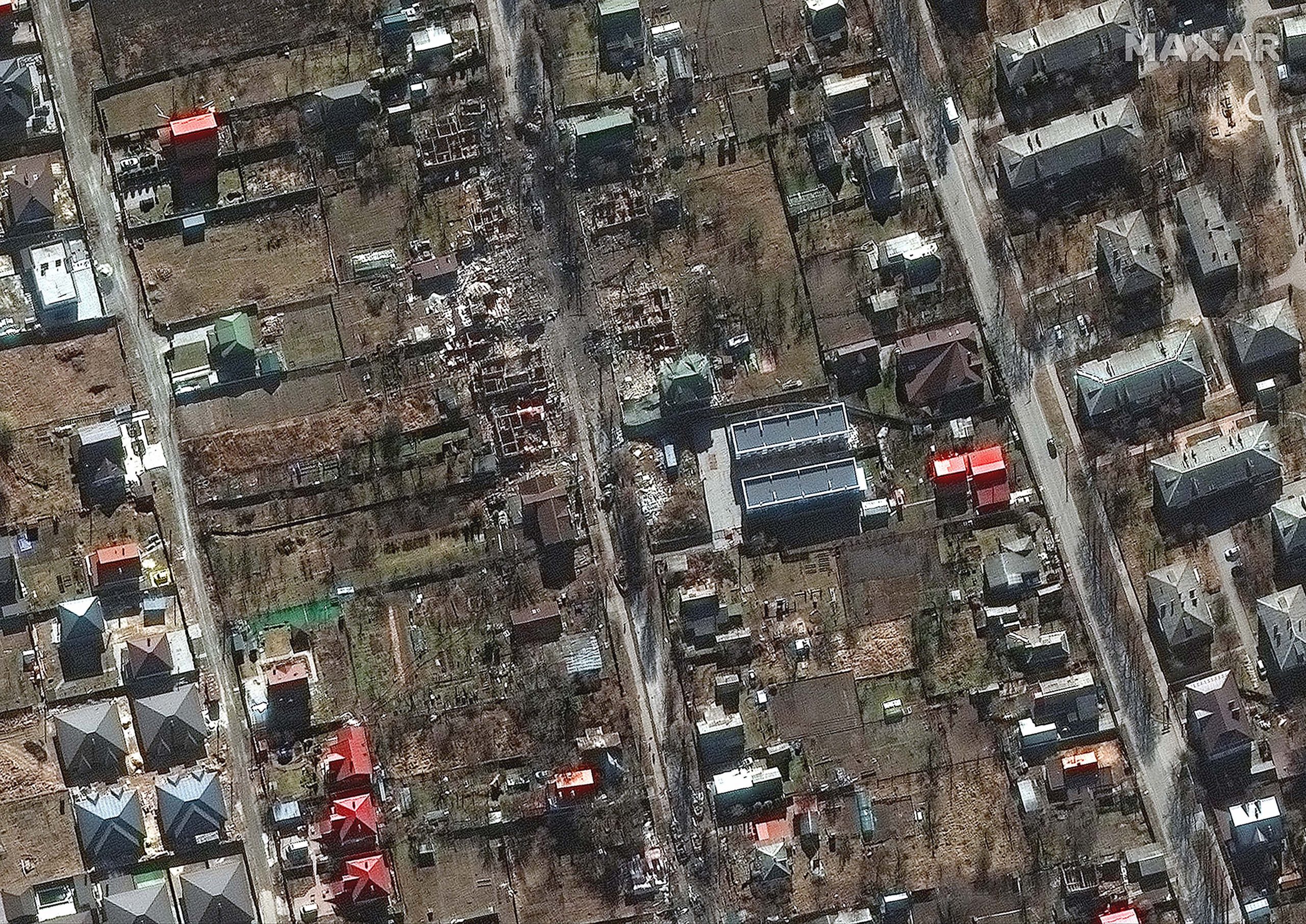
Satellite image of
a 64 km-long Russian convoy marching towards Ukraine capital Kyiv alerted the
world to Vladimir Putin’s precise intentions. The image, captured by Maxar
Technologies, a US-based space tech company, has significantly influenced the
way war images are captured and interpreted and shown the power of satellite
imagery in war reportage. No longer do governments have monopoly over satellite
data and open-source analysts can offer real-time assessments of battleground
developments.
Coverage of the
Ukraine war has been a giant leap forward for satellite technology. While
Vladimir Putin announced a “special military operation” in Ukraine, satellite
images captured that the invasion was actually underway on February 24. Only a
few hours after Putin’s speech, Google Maps showed a traffic jam from Belgorod
in Russia to Ukraine, Jeffrey Lewis of the Middlebury Institute in California
tweeted, according to an AFP report.
The
technology
Once upon a time,
satellites required daylight and clear skies to capture images. But newer
versions, like the ones used by Capella Space, work with a synthetic aperture
radar (SAR). According to company vice president Dan Getman, SAR manages to
penetrate clouds and smoke, even in very large storm events or fires. “So, we
can reliably capture clear images of the Earth under almost any conditions,”
Getman said.
There are two
major types of satellites in use – SAR and Optical imagery. SAR helps to capture
small-scale movement. It can work all day and night. Optical imagery, on the
other hand, has to use visible or infrared light.
BlackSky, another
company that the global media has looked to for accurate goings-on in the war
effort, was among the first to report engagements of the war. “We have a
constellation of small satellites that can see from dawn to dusk, not just at
certain times of the day,” said Brian O’Toole, CEO of BlackSky told AFP.
The dark side
While tracking
troop movements has helped understand the devastation in Ukraine, the selective
release of satellites has triggered ethical concerns.
Satellite tech companies,
such as Maxar and others, “are inevitably capturing imagery of Ukraine troop
movements and keeping that information to the public, said Chris Quilty of Quilty
Analytics to AFP.
The key ethical
concern is that there is an attempt to colour the narrative on the basis of
available images.


