
The 2023 hurricane season has brought Southern California into the National Hurricane Center’s cone of uncertainty. As the region braces for a rare encounter with a significant hurricane threat, Tropical Storm Hilary, currently a Category 1 storm, is anticipated to intensify into a powerful Category 4 hurricane, making its mark on both Mexico and the Southwestern United States.
The sight of Southern California cities like San Diego and Los Angeles in the hurricane forecast cone has surprised many, given the region’s usual immunity to such tropical systems. The hurricane threat marks a rare occurrence, with the potential for heavy rain and flooding posing a significant concern for the Southwestern US early next week.
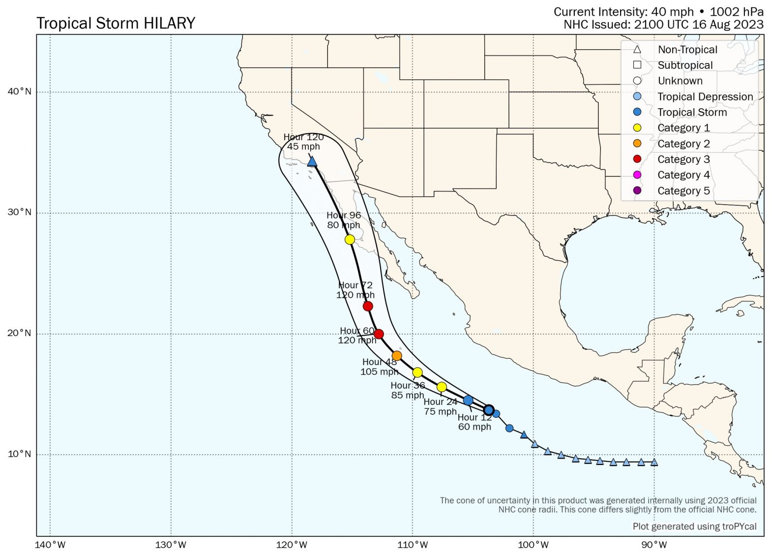
As of Thursday morning, Hilary had evolved into a Category 1 storm, boasting sustained winds of 85 mph and a central pressure of 980 mb. Positioned about 365 miles south-southwest of Mexico’s Baja California Peninsula, Hilary is moving west-northwest at 14 mph. This rapid intensification saw Hilary gain 45 mph in wind speed over the span of just 24 hours since its formation on Wednesday.
Guided by a low-pressure trough off the California coast and a strong ridge of high pressure over the central US, Hilary’s trajectory is anticipated to shift northwest on Friday and north-northwest on Saturday. This path is likely to keep the storm parallel to Baja Mexico’s coastline, initiating heavy rains for the region from Thursday evening onwards.
The hurricane, surrounded by a moisture-rich air mass boasting 80% relative humidity at midlevels, has the potential to bring rainfall of three to six inches across Baja California, along with isolated amounts reaching up to 10 inches.
Hilary’s intensification is set to continue, driven by favorable conditions including warm ocean waters around 86°F (30°C), low wind shear, and high atmospheric moisture. The intensity models, including official forecasts, are bullish, with expectations for Hilary to escalate into a major Category 4 hurricane. This peak intensity is predicted to occur on Saturday, as Hilary approaches the southern tip of the Baja Peninsula.
While the storm is predicted to weaken over colder waters by Sunday, its large size could lead to a slower decrease in intensity compared to smaller hurricanes. The National Hurricane Center projects Hilary to transition into a strong tropical storm with 60 mph winds by Monday morning, placing areas like San Diego at risk of experiencing tropical storm-force winds.
The overarching concern in the Southwest US remains the potential for heavy rainfall. The National Weather Service Weather Prediction Center has issued a “moderate” risk outlook for excessive rains, highlighting the possibility of flash flooding over parts of the far Southern California desert. Rainfall amounts of two to four inches, with isolated higher amounts, have been predicted for the region.
Also Read: Why did Taylor Swift turn down the opportunity to play at Super Bowl 58?
While California and Southern Baja California are no strangers to tropical cyclones, their rare appearances are often marked by heavy rainfall and localized flooding. Historical instances like Hurricane Kay of 2022 and the 1939 tropical storm are reminders of the unusual blend of factors required for such systems to impact these regions directly.


