
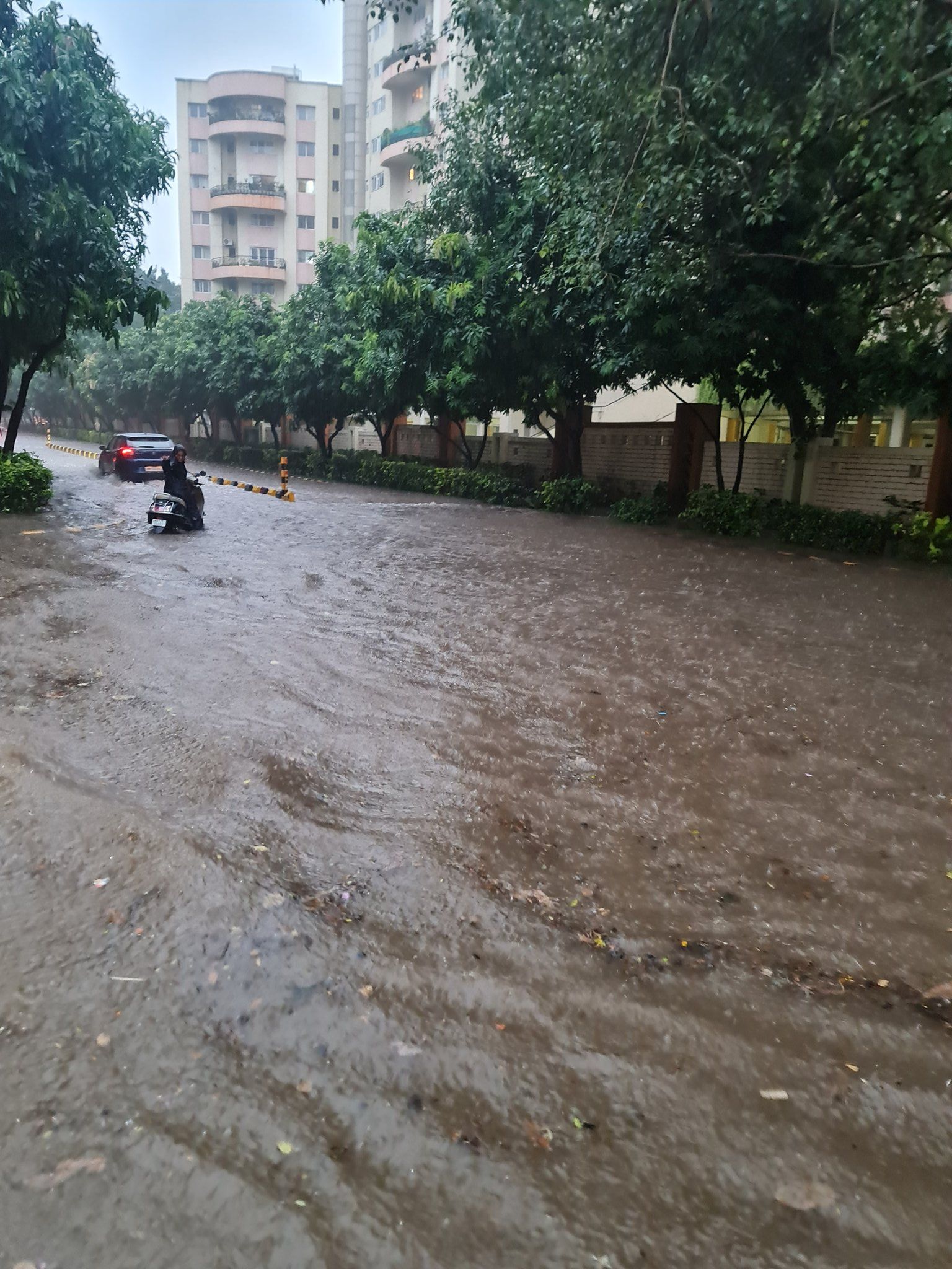
Several parts of the city of Pune, Maharashtra reported waterlogging after heavy rains hit the city on the evening of Sunday, September 11, 2022.
The cloudburst over the city led to traffic gridlocks with several roads experiencing high water levels, leaving many vehicles submerged. The heavy rains hit the city between 5 pm and 7pm. It’s not just Pune that has been hit, residents of Maharshtra can expect to see heavy rainfall in the next few days, according to the Indian Meteorlogical Department.
City residents tweeted out videos of traffic snarls and submerged streets.
In just under a few hours, low lying areas of the city like Wanaori, Hadapsar, Pashan and Magarpatta recorder over 60 millimetres of rainfall. Locals even experienced power cuts, which the Maharashtra State Electricity Distribution Company Limited said in a statement was because “technical snags had developed due to waterlogging after the incessant downpour.”
Apart from the rains and water logging in Chandannagar, Kothrud, Paud Road, Pashan, Wanwadi, B T kawade Road, Katraj garden and Swargate, there were incidents of trees falling as well. Incidents were reported in Pashan, Kondhwa, Pune station, and Yerwada, according to a fire brigade official. No one was injured in any of the areas.
The IMD said that that the Pashan and Magarpatta areas had received 55.8 and 55.5 millimetres of rainfall respectively and that it had issued an orange alert for “heavy to very heavy rainfall” in the ghat areas. Pune itself has received a red alert over the next three days, while a yellow alert has been issued in the coastal districts of the Konkan regions, according to a report from Times Now.
The rains in Pune, also known as the cultural and educational capital of Maharashtra, comes just days after torrential rain in Bangalore clogged streets, left cars submerged and people being forced from their homes. However, it seems that workers in Bangalore are headed back to work today, September 12 2022 given that the rains have subsided and easing the flooding situation in various parts of the city.
Other IMD forecasts
The extended rainfall in the region is because of a depression, i.e., low pressure in an area, in Odisha and its movement. The depression will move west-northwestwards, according to an IMD weather report and will go through Odisha into southern Chattisgarh before weakening gradually.
Cyclonic circulation off the Maharashtra-Goa coast is also contributing to keeping the rains in Maharashtra extended, more so in the Vidarbha region, an IMD official told the Indian Express.


