
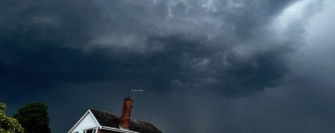
This morning, a belt of anticipated heavy storms was apparently preceded by a tornado that tore across the wiregrass region.
Approximately 2,300 people live in Abbeville, the county seat of Henry County in southeast Alabama, which is located just west of the Georgia state line. Social media reports showed the storm moving quickly through the town.
Also Read: Over 40 million Americans on alert as severe storm threat looms from Colorado to Georgia
No early reports of injuries were available as of 11:30 a.m., although there were reports of Singletary Road structure damage. In the social media video, there were also fallen trees and roofs with missing shingles.
Alabama has already experienced one wave of storms this morning, and numerous rounds of more storms are anticipated throughout the day.
Baseball-sized hail could also be present in the storms. Additionally, there is a chance for severe tornadoes.
This week, the Northwest Florida region is likely to see extreme weather, including strong thunderstorms and torrential rain.
According to the National Weather Service office in Mobile, Alabama, the area is predicted to experience three waves of severe weather on Wednesday and Thursday.
Wednesday’s chance of severe weather is “enhanced” for Escambia and Santa Rosa counties while it is “moderate” everywhere.
Thunderstorms are anticipated to pass over the area from early Thursday through Wednesday, according to the meteorological service, though the exact timing is still undetermined. The first round will take place on Wednesday between 9 am and 2 pm, the second round will happen between 6 pm on Wednesday and 4 am on Thursday, and the third round will happen between 12 pm and 8 pm on Thursday.
There is a possibility that the storms will produce tornadoes, big hail up to 2 inches in diameter, and damaging wind gusts above 70 mph.
Additionally, each thunderstorm cluster will produce “torrential rainfall” and recur over the same regions. 2 to 4 inches of rain are anticipated, with up to 6 inches possible in excess. In Northwest Florida, the risk of flash flooding will be greatest in regions inland.


