
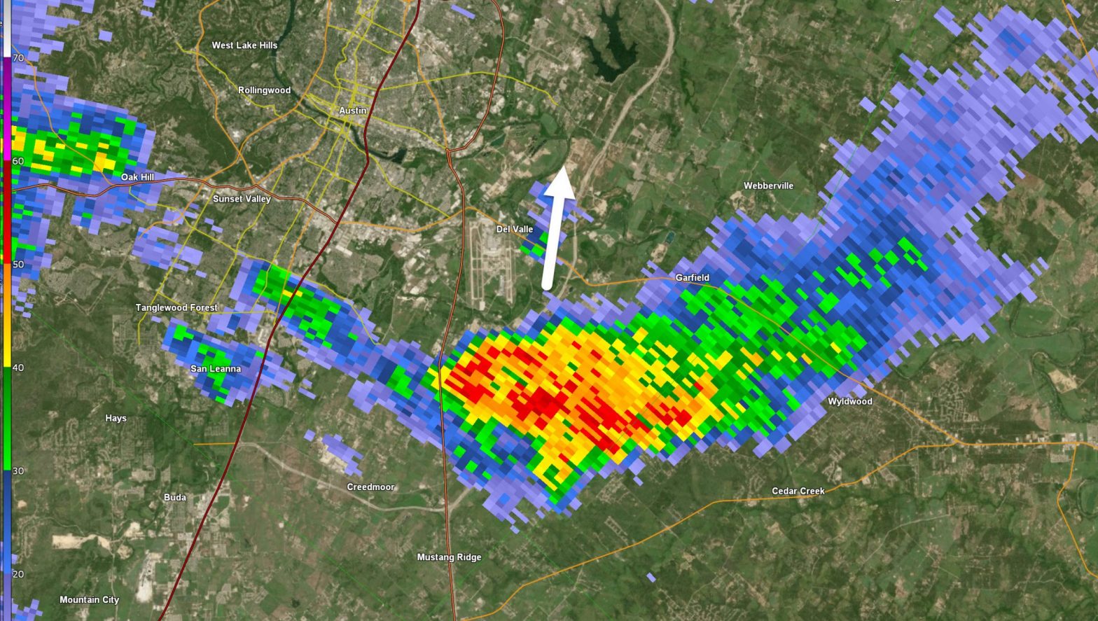
The National Weather Service has issued a tornado warning for specific areas in southeastern Travis County, near the borders of Caldwell and Bastrop counties, set to be in effect until 9 a.m. Additionally, Austin and other regions within Central Texas are currently under a flood watch for the day, with a special advisory for morning commuters to exercise extra caution when venturing to work.
Also Read: Where is Robert Card from?
Furthermore, Burnet and Blanco counties have been placed under a flood warning by the weather service, and parts of the Hill Country have been designated with a flash flood warning. Counties situated along the Interstate 35 corridor, including Hays, Travis, and Williamson counties, are also encompassed within the flood watch.
Anticipated weather conditions suggest that portions of Central Texas could experience rainfall ranging from 1 to 3 inches throughout the day.
It is crucial for both pedestrians and drivers to remain vigilant in the face of potentially hazardous conditions. If a roadway appears to be flooded, the safest course of action is to turn back.
Also Read: What is Robert Card’s political affiliation?
In terms of the weather outlook, rain chances in Austin are expected to persist at elevated levels through the remainder of the morning and extend into parts of the afternoon. However, these chances are anticipated to gradually diminish as the day progresses, with a more significant decrease expected by evening, as outlined by the National Weather Service.


