
Turkey has been rocked by a series of massive earthquakes, which has killed over 2,500 so far but the death toll is predicted to rise. The first deadly magnitude-7.8 quake was followed by a second, 7.7 quake in the middle of the day on Monday. This was followed by two more powerful tremors that rocked the middle eastern country.
But why were Turkey and its neighboring Syria hit with such massive earthquakes within a span of 12 hours? Twitter user @sinemtheturk explained the science behind why the nations were impacted at such an enormous scale by back-to-back natural disasters.
Also Read | Who is Christian Atsu, ex-Chelsea footballer trapped under rubble after Turkey earthquakes?
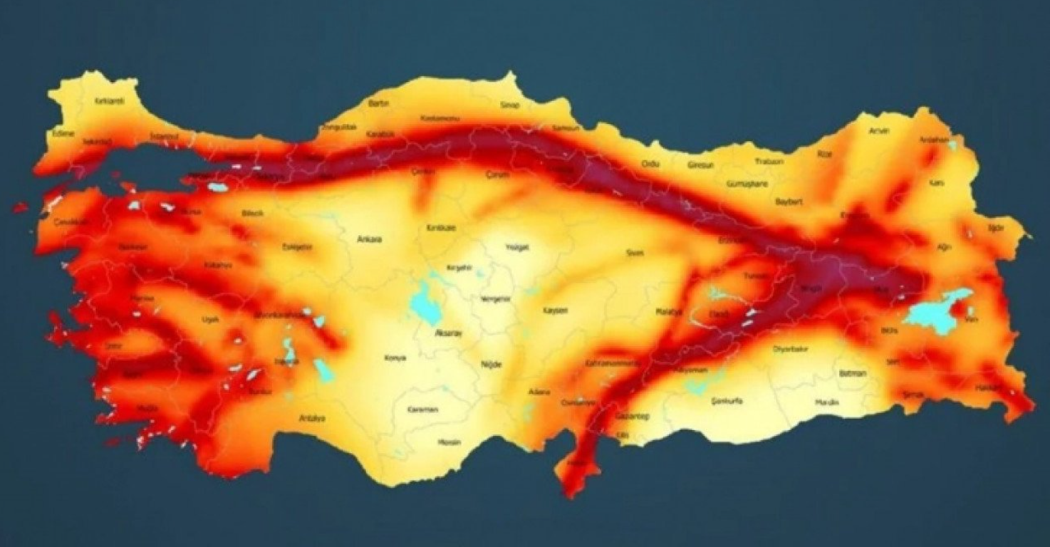
“For those who don’t know: This is Turkey’s earthquake map. Today, unfortunately, a huge fault line broke between Kahramanmaraş and Malatya. This is the reason why such strong and frequent earthquakes occur. The last time such an earthquake occurred in the same region was in 1513,” the user wrote.
I need to clarify this: the earthquake happened in the eastern Anatolia region. That map I shared above is all earthquake zones in Turkey. I forgot to write that detail. This is where it happened and was felt in our many eastern cities: pic.twitter.com/WJTfWxKeVz
— Sinem (@sinemtheturk) February 6, 2023
In the following tweet, the user explained: “I need to clarify this: the earthquake happened in the eastern Anatolia region. That map I shared above is all earthquake zones in Turkey. I forgot to write that detail. This is where it happened and was felt in our many eastern cities.” The user added a few hours later that the “stress shifted further south/southwest after the fault broke, now Adana and Hatay provinces (2nd photo) need to pay attention because the faults there are stretching right now.”
Also Read | Young Turkish girl pulled out of rubble after earthquake ravages Sanliurfa province: Watch
According to the user, who is from Turkey, 79 aftershocks occurred after the 7.4 magnitude earthquake. The user also informed that these aftershocks associated with this earthquake could occur for up to one year. Some of them could have a magnitude of 5-6.


