
Hurricane Hilary has strengthened to a major category 4 storm with an extreme flash flood threat for the Pacific Northwest. In the trajectory of its movement lies Las Vegas.
According to National Weather Service San Diego, the hurricane in currently operating with the maximum sustained winds of 140 mph. The storm could bring “significant” impacts to Southern California and the Southwest by the weekend and into the first part of next week.
“Rainfall impacts from Hilary within the Southwestern United States are expected to peak this weekend into Monday,” the NHC said in an advisory. “Flash, urban and arroyo flooding is possible with the potential for significant impacts.”
Will Hurricane Hilary hit Las Vegas?
It is slated to become the first tropical storm to make landfall in California in 84 years, officials say. Over the weekend, the abundant tropical moisture could be flowing into California, Nevada and Arizona. According to maps being shared on social media, Las Vegas is directly in the path of a Category 4 hurricane.
Hilary will bring 5-10 inches (125-250mm) of rain to places like Palm Springs, Death Valley and Las Vegas. A Flood Watch has been issued for all of Southern Nevada as the moisture from Hurricane Hilary surges into the area.
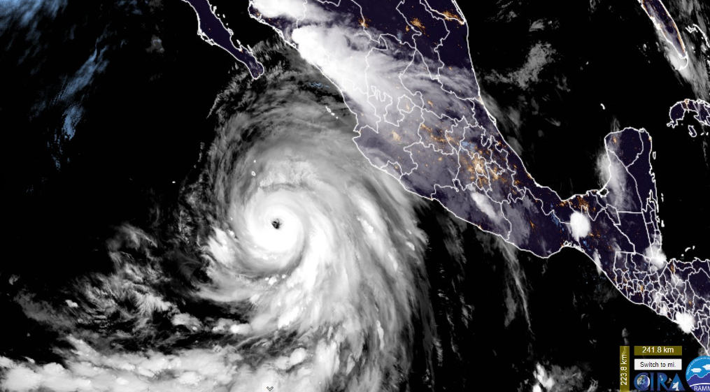
As of Friday, the hurricane is located about 400 miles south of Cabo San Lucas, Mexico. It is moving to the west-northwest at 13 mph. According to the NHC, Hurricane Hilary is expected to turn to the northwest on Friday morning before turning northward over the weekend. It is expected to approach the Baja California peninsula on Saturday.
“Hurricane-force winds extend outward up to 45 miles from the center and tropical-storm-force winds extend outward up to 290 miles,” the NHC said.


