
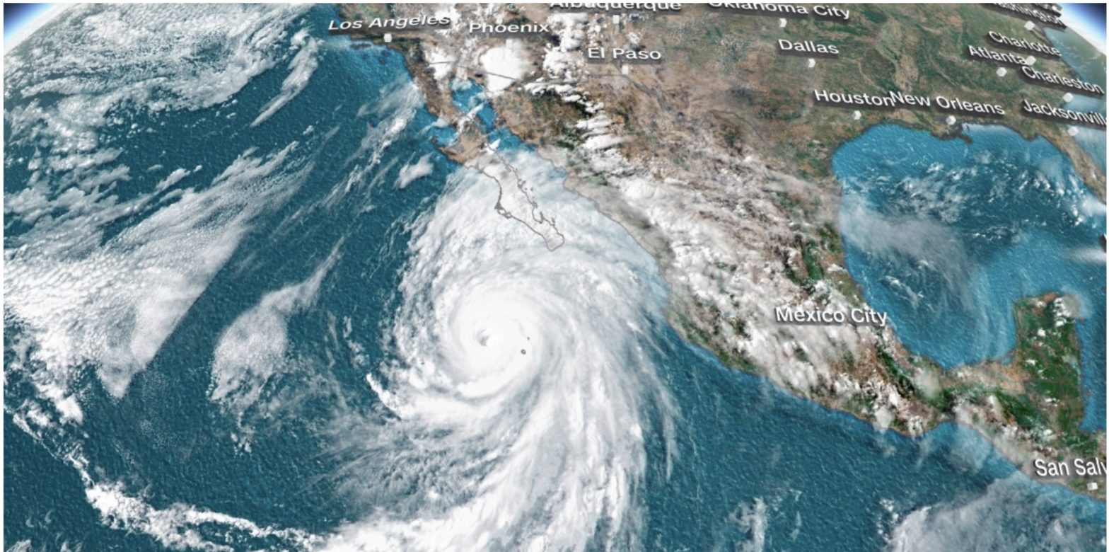
Overnight, Hurricane Otis struck the vicinity of Acapulco, Mexico, with the fury of a Category 5 hurricane, boasting winds reaching a staggering 165 mph. This meteorological event was notable for the swiftness of its development, having transitioned from a tropical storm in the morning to a Category 5 hurricane by evening, setting a record for the fastest strengthening ever recorded in the northeast Pacific.
Despite the ferocity of the storm, initial reports from Mexican President Andrés Manuel López Obrador indicated a lack of information regarding casualties. He revealed the challenging situation in the affected areas, where communication had been severely disrupted.
The Mexican government’s primary concern currently lies with a string of coastal towns stretching from Acapulco northward to the popular beach resort of Zihuatanejo. These areas, already grappling with the aftermath of the hurricane, have also been confronted with violence between organized-crime groups vying for territorial control.
In one of the impacted towns, Coyuca de Benitez, a tragic incident unfolded as gunmen carried out a massacre, resulting in the deaths of a dozen municipal police officers and the local security director. In response, the federal government swiftly deployed approximately 300 National Guard troops to the region, situated around 30 miles northwest of Acapulco.
President López Obrador acknowledged the difficulty in establishing contact with the affected towns to assess the extent of damage and casualties. He affirmed the government’s commitment to addressing the situation and initiating relief efforts as soon as communication is restored.
Hurricane Otis’s remarkable rapid intensification, transitioning from a tropical storm to a Category 5 hurricane within a mere half-day, aligns it with an increasing number of storms worldwide experiencing what scientists term “rapid intensification.” This phenomenon, attributed to climate change, entails a significant boost in a storm’s peak winds, with a minimum increase of 35 mph within a 24-hour period.
Also Read: Who was Nic Kerdiles? Former fiancé of Savannah Chrisley dies in motorcycle accident
To undergo rapid intensification, tropical cyclones require warm waters to draw energy from, which they convert into intensified wind speeds and heat release. Researchers believe that as the global climate continues to warm, there is more energy available to fuel tropical storms, making rapid intensification an increasingly frequent occurrence.
The past few years have seen a surge in the frequency of hurricanes rapidly intensifying before making landfall in the United States, with Hurricane Ian being one of the most recent examples. These events underscore the pressing issue of climate change, as rising ocean temperatures, influenced in part by phenomena like El Niño, contribute to the proliferation of extreme weather events such as Hurricane Otis.


